
A Potted History
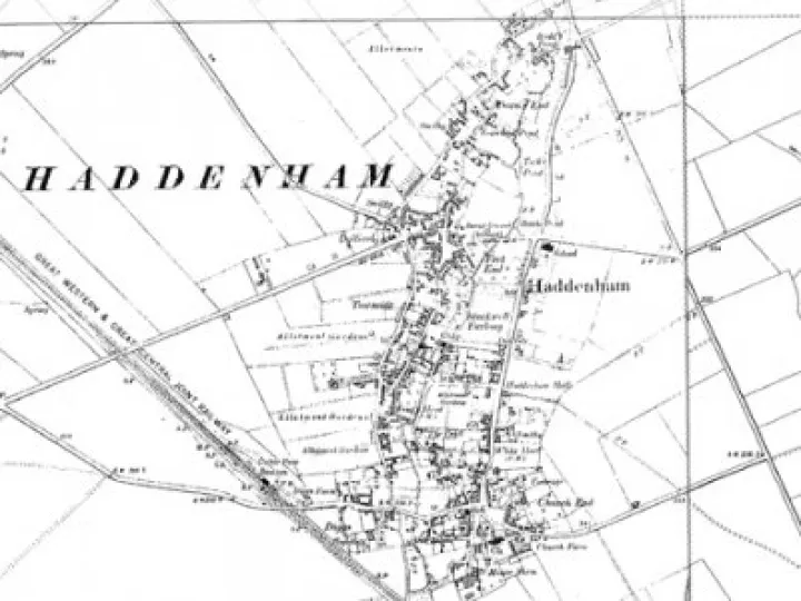
Haddenham is situated in the Vale of Aylesbury, in south-west corner of Buckinghamshire and very close to the border of Oxfordshire, in the UK. The village is bounded on three sides by the River Thame and its tributaries – the Dad Brook, and the Ford Brook. The village has fine examples of witchert houses and walls.
The name Haddenham is commonly thought to mean Hadda's Homestead. Hadda was a Saxon who reputedly settled by a stream after sailing up the River Thame. More recent research suggests that the earliest settlers were Anglo-Germans pushed south after a defeat at the battle of Bedcan Ford, near Luton in Bedfordshire in 571AD.
Haddenham was mentioned in the Domesday Book – where it was misspelt as Hedreham.
The Parish Church of St Mary the Virgin was built about 1215.
The Enclosure Acts came late to Haddenham. It was not until 1834 that the old strip system of farming was transformed into the field system as we know it today.
The Great Western Railway came to Haddenham in 1905 and the Station opened in 1906. The station was closed in 1963. Haddenham and Thame Parkway Station then re-opened in 1987 at the top of Thame Road.
Electricity came to the village in 1928, followed in 1936 by mains drainage.
An airfield was constructed in the mid 1930's when there was talk of Haddenham becoming a major airport!
During the Second World War the airfield was used for glider pilot training, and subsequently developed for light industry.
Today the village still retains many of its old buildings and features. As a result of its character it is often used as a period location by film and TV production companies.
Haddenham does not feature in the nation's history books but still has a long story of its own. It was thriving in 1066, as noted in the Domesday book, when it was recorded Nedreham (or was it Hedreham?). You will find both these spellings in the museum.
1825 Pre Enclosure Map
On display in the museum is an enlarged copy of a painstakingly drawn map of the Haddenham Parish as it existed just before the Enclosure.
The Map was drawn by a young man dying of 'consumption' who worked with information from his aged Father.
Thousands of the ancient one acre arable strips are depicted, with those held by the Father's own Father being scattered across the three big open fields of the Saxon system.
Over 150 names of the land areas are included. Some are evocative such as Elder Stub, Gog, Long Honey Furlong and Short Honey Furlong; while others are mysterious, such as Hoppice, Punchless, Rumpith, Brimble and Quilling. Most of these names would have disappeared from all records had it not been for this remarkable map.
Witchert
Witchert is the local name for mud walling, a crude but effective method of building which has continued in use for thousands of years in all parts of the world. The method of construction varies from place to place according to the properties of the local earth, as does the name; pise de terre in France, mass cob, clom or korb in central England, clay lump in Norfolk.
First a foundation of rough stone was laid, wider below ground than above, and continued up for about a foot to an even course. This upstand was called the "grumpling". When the grumpling is completed, the witchert, is laid down in courses. Each course is then called a 'berry'. One berry must be left to dry before another is put onto it. When the berry is about 'two-thirds' dry the sides are trimmed straight with a flat spade, and each must be so trimmed before the next is put on to it.
The most important element of a cob wall is its roof; this is necessary to keep the rain off the top of the wall, and overhanging sufficiently to protect the face of the wall as much as possible. The wall top should never be left exposed to the weather.
The Tallest Witchert Building in the world is reputed to be the Methodist Chapel (1822) which collapsed in July 2001(!) and the Widest Building in the world is reputed to be the Baptist Church (1809).
One of the stands in the museum gives information on witchert, and the building itself is constructed of this material, as is the adjoining Methodist Church.
There is an old saying, that if you had an enemy then you should leave them an old witchert cottage in your Will. Then they would never stop having to put their hands in their pockets to pay out repairs!
Ducks
Many people in Haddenham used to breed the large white Aylesbury Ducks keeping them on the many village ponds around the village. They thatched the pond by St. Mary's Church, Church End to stop the ducklings getting wet and Haddenham earned the name 'silly Haddenham'. Not so silly, though, because baby ducks drown if they get their feathers wet before they are fully grown! The pond at Church End is one of three remaining ponds in the village, one being at the top of Rudds Lane and the other along Banks Road by the shops.
Aerodrome
Haddenham aerodrome was the home of the No 1 Glider Training School during the last war. The gliders were not there for long – as you may see from one of our stands – but during that time the King and Queen came to Haddenham to see a demonstration of gliding. There is also a photograph taken after the war of a row of Halifax bombers on Haddenham airfield. You can find out what they were doing there.
The aerodrome today is home of the Upward Bound Trust which is a registered charity formed with the aim of providing young people 'the gliding experience' at a reasonable price. It has been operating here in Haddenham for over 30 years.
The Haddenham Handbook
The listing of organisations and services on this website owes its origins to The Haddenham Handbook. The original Handbook was created in 1995 by a group of young people at the Haddenham Youth Centre who were undertaking their Duke of Edinburgh Award.
Compiling the directory was a major task, took a lot of time, and involved a considerable amount of hard work by the young people, under the guidance of the Youth Club team. The production of the published Handbook was made possible through donations and sponsorship and was delivered free to every house in Haddenham (by the young people).
June Jones, the editor of Haddenham.net in its early years, helped with advice and in building additional contacts and, when the directory needed to be updated for a second issue in 1997, June was instrumental in taking this forward. The main challenge in producing a paper booklet was in keeping it up-to-date, and this is why the directory was incorporated into the website in electronic form. Funding from the Parish Council was obtained to support this.
Unfortunately, even in electronic form, the database was not kept up-to-date. So, when Keith Milmer re-designed and re-launched Haddenham.net in July 2012, the database had to be recreated virtually from scratch. Nevertheless, the hard work of Haddenham's youngsters in the mid-1990s provided Keith with an excellent structure from which to begin the task. So, once again the directory of organisations and service providers on Haddenham.net offers a comprehensive and up-to-date source of information for everyone.