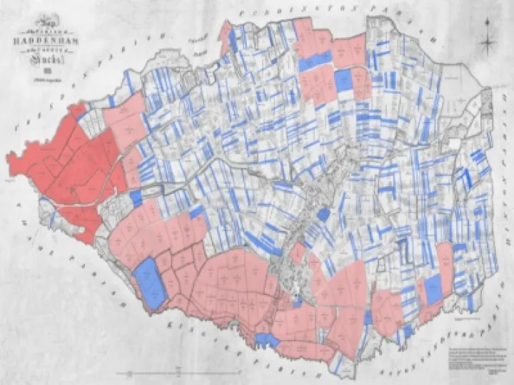
Haddenham has a very unusual map made in 1820, when Napoleon was still alive and the Prince Regent became George IV. The map shows the village houses, streets, ponds and church; around those houses, it shows three huge fields, divided into hundreds of strips, just as they had been since the time of the Anglo-Saxons. Better still, there is a key to the map which tells us who owned and farmed those strips and which houses they lived in. The map will be on display in the Museum from March.
Haddenham Museum is collecting other information to help interpret the map. But this map is only one of the exceptional documents which Haddenham Museum contains. Haddenham in the first half of the 19th century is particularly interesting, because in 1830-34 the medieval strips were replaced by the hedged fields and separate farms that surround us today. We want to put the map and the other historical evidence about Haddenham between 1800 and 1850 onto the Internet, as other villages in Bucks are doing. Then you and everyone will be able to check it out, find out who lived in your house or farmed your garden; if you have the deeds of your property, or old photographs or plans, you will be able to add them.
WE NEED YOUR HELP:
we want to hear from anyone of any age, who would like to join us in bringing Haddenham's history to life. We need people with computer skills to help to manage the database, people with typing skills to transcribe documents, people to photograph the surviving buildings, and people to become detectives in the Centre for Bucks Studies and the National Archives.
If you can help, please contact Cynthia Floud email: cynthia.floud@btinternet.com Tel: 291086; or Elaine Parkes email: emparkes26@gmail.com Tel: 292184